


5 Facts on Lake Constance

- Zum Vergrößern bitte anklicken
Those facts on Lake Constance, you should know:
Lake Constance for drinking water
Annually to the Lake Constance are taken around 180 million cubic meters of water through 17 water plants for drinking water supply of a total of about 4.5 million people in the countries bordering Germany and Switzerland. It is noteworthy that, overall, still more water evaporates naturally than is taken as for drinking water. Drinking water quality is considered excellent.
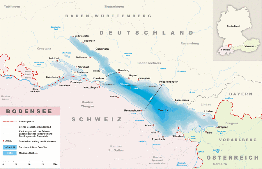
Curvature of the earth: The other side is not visible
Due to the curvature of the earth, the surface of Lake Constance in its southeast-northwest extension (65 km) around 80 m arched. From a human perspective, it is impossible, even with the best distance vision, to look from the east bank of the upper lake (eg, Bregenz) on its west bank (such as Constance).
Durability of Lake Constance: 10,000 years
Against the natural erosion from the mountains, the man can not do much, despite his technique and his knowledge. The new Rhine delta in Lake Constance can not prevent the filling of the lake over time. Despite all efforts, the detritus from the Alps will fill into Lake Constance. Under the same climatic conditions, Europe's largest drinking water reservoir will be gone in about 10,000 to 15,000 years. (Source: ZDF, Abenteuer Wissen)
Skating only twice per century
Since the year 875 Lake Constance (Upper Lake) has been frozen completely a total of 32 times, so that the lake was safe everywhere to cross on foot. The last so-called Seegfrörni was in 1963. Certain parts of the lake like the so-called Markelfinger Winkel e.g. to freeze more often, mainly because of the low water depth and sheltered location.
4m height difference between summer and winter
Well those are the extreme values, however, through the inlet and outlet, the water levels between summer and winter differ but several meters. The absolute highest water levels were at Konstanz levels with the 6.36 m 7 July 1817, 5.91 m on 18 August 1821 and 5.65 m on 24 Measured in May 1999. The lowest seasonal water levels occur in winter, in the months of February and March, when in the Alps, snow falls as precipitation. The lowest level at constant water levels were 2.26 m on 17 February 1858 and 2.29 m in February 2006.